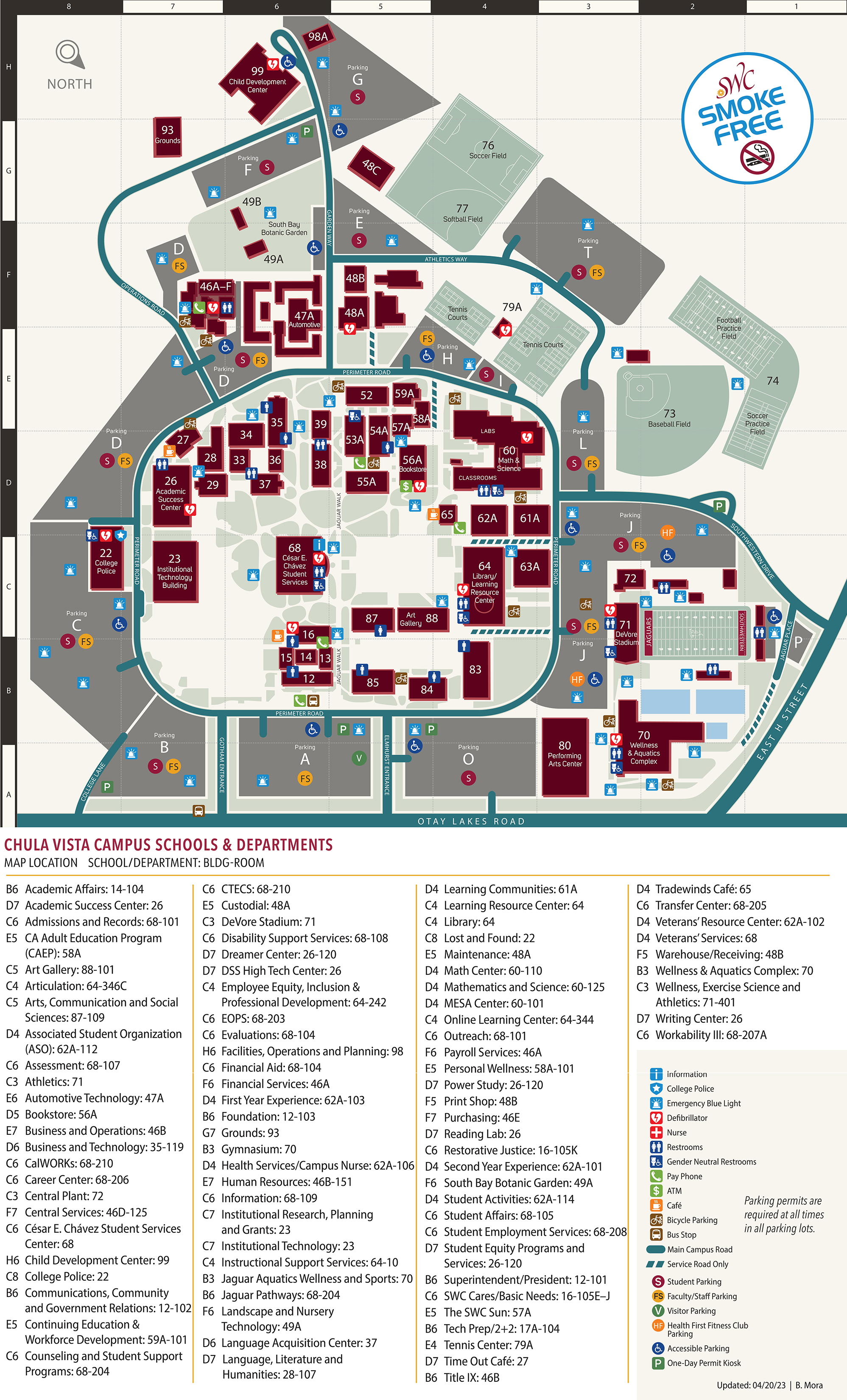
Chula Vista Campus
Campus Map

900 Otay Lakes Rd
Chula Vista, CA 91910-7297
Driving Directions
- From 805 North or 805 South
Exit East "H" Street
Go Right onto East "H" Street
Go approximately 3.5 miles
Turn Right on Otay Lakes Road - From 5 North or 5 South
Take 54E to 805S
Exit East "H" Street
Go Right onto East "H" Street
Go approximately 3.5 miles
Turn Right on Otay Lakes Road
Recorded driving directions are available by calling (619) 482-6520.
Public Transportation
Take the trolley to either:
- Chula Vista Bayfront Trolley Station (E Street) and transfer to Chula Vista Transit Bus Route 705A to Plaza Bonita/Southwestern College.
- Chula Vista H Street Trolley Station and transfer to Chula Vista Transit Bus Route 709/709A to Southwestern College/Otay Ranch Town Center.
- Chula Vista Palomar Street Trolley Station and transfer to Chula Vista Transit Bus Route 712 to Southwestern College.
- The Route 707 also provides service from Otay Ranch Town Center to Southwestern College via East H Street and Eastlake Parkway.
For transit information please visit the sdcommute.com. For traffic, transit, and travel information please visit 511sd.com.
Points of Interest
Other SWC Campus Maps
Crown Cove
Take a look at the Campus Map and Directions for Crown Cove Aquatic Center.
National City
View the Campus Map and Directions for the Higher Education Center at National City.
Otay Mesa
View the Campus Map and Directions for the Higher Education Center at Otay Mesa.
San Ysidro
Take a look at the Campus Map and Directions for the Higher Education Center at San Ysidro.